How tall is Mount Everest? Understanding the Majestic Height
“If you’ve ever wondered, ‘How tall is Mount Everest?’ prepare to be awestruck by its majestic height of 8,848.86 meters and its history.”
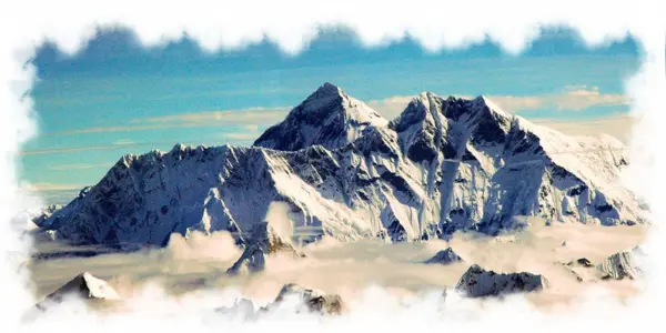
Mount Everest, the world’s highest peak, has captivated the human imagination for centuries. Towering at an elevation of 8,848 meters (29,035 feet) above sea level, this majestic mountain is situated in the Mahalangur Himal range, making it an irresistible climbing destination for adventurers worldwide. Similarly, the Everest Base Camp became the alternative choice for trekkers who want to get a challenging adventure and to be part of Everest.
As the world’s highest mountain, it has been a subject of fascination and curiosity for centuries. However, the precise height of Mount Everest has been a topic of intense debate, with various surveys and measurements yielding different results. In a momentous joint declaration, Nepal and China have now officially announced the new height of Mount Everest, putting an end to decades-long uncertainty surrounding this iconic landmark.
Nepal Peak Adventure proudly presents an informative exploration of the height of Mount Everest, delving into its historical measurements, controversies, and fascinating geographical aspects.
Table of Contents
The Great Trigonometric Survey and Everest’s Height:
The Great Trigonometric Survey, a monumental endeavor undertaken by the British in the early 19th century, played a crucial role in the determination of Mount Everest’s height. This ambitious survey aimed to fix the names, heights, and locations of the world’s highest mountains, including the towering peak of Mount Everest.
The surveyors equipped themselves with massive theodolites, sophisticated measuring devices based on geometrical angles, weighing around 500 kilograms (1,100 pounds) and requiring 12 men to carry. Setting out from southern India, the survey teams embarked on a challenging journey northward toward the Himalayan foothills in the 1830s.
However, their path was not without obstacles. Nepal, the land where Mount Everest majestically stood, was hesitant and suspicious of British colonial ambitions, political aggression, and potential annexation. As a result, the survey teams were unable to reach the Himalayas during their initial attempts.
Despite the setback, the determination to measure Everest’s height persisted. Eventually, in 1847, the British surveyors managed to obtain a height measurement of 8,778 meters (28,900 feet) for the mountain. This initial measurement laid the groundwork for subsequent surveys and investigations.
The Indian government later conducted a survey in 1954, which estimated the height of Mount Everest to be 8,848 meters (29,029.24 feet). This figure was widely accepted and trusted by researchers and geologists for over five decades.
However, the accuracy and reliability of various surveys started to be questioned in 1999, leading to further remeasurement efforts using advanced technology. Chinese, Italian, and American research teams conducted their surveys, employing techniques like Global Positioning System (GPS) and ice-penetrating radar.
Controversies and Remeasurement Efforts
In 1975, a Chinese research team declared Mount Everest’s height to be 8,848.11 meters (29,029.24 feet), which was close to the previously accepted measurement. However, as technology advanced and more accurate methods became available, the accuracy and reliability of these early surveys came into question.
By the late 20th century, researchers began to undertake remeasurement efforts using modern technology, such as Global Positioning System (GPS) and advanced satellite imaging. An Italian scientist group utilized GPS and laser measurement technology in their survey. Subsequently, an American research team from the National Geographic Society employed GPS technology in their measurements.
Each new survey produced slightly different results, creating confusion and disagreement over the precise height of Mount Everest. The discrepancies ranged from a few meters to fractions of a meter, but they were enough to cast doubt on the previously accepted figures.
In 2005, a Chinese survey conducted by the State Bureau of Surveying and Mapping stated the height as 8,844.43 meters (29,015 feet). Then, in 2010, a joint Chinese-Nepalese survey arrived at a figure of 8,848.16 meters (29,031.4 feet). These surveys further contributed to the ongoing controversies and discussions.
The Impact of the 2015 Earthquake on Everest’s Height
On April 25, 2015, Nepal was struck by a devastating earthquake with a magnitude of 7.8. The earthquake had far-reaching consequences, causing widespread destruction and loss of life in the country and the surrounding region. One of the areas of concern following the earthquake was its potential impact on the height of Mount Everest, the world’s highest peak.
Geologists and researchers speculated that the powerful earthquake might have caused a shift in the mountain’s position and, consequently, could have altered its height. The massive seismic event had the potential to reshape the landscape and geological features in the region, including the Himalayan Mountain range.
In the aftermath of the earthquake, there were discussions and debates among experts regarding whether the height of Mount Everest had changed. It was a subject of curiosity and concern for both the scientific community and the adventure tourism industry, as the mountain’s height is a matter of significant importance and interest.
To address these speculations and provide accurate information, the Nepalese government decided to take action. They dispatched a team of experts to Mount Everest with the mission to conduct a detailed measurement of the peak’s actual height for the first time since the earthquake.
The research team used various advanced techniques, including ground-penetrating radar and the Global Navigation Satellite System (GNSS), to measure the mountain’s height with meticulous precision. The measurements were conducted under close scrutiny and with great care to ensure accuracy and reliability.
The study aimed to determine whether the 2015 earthquake had, in fact, impacted the height of Mount Everest. The findings of the research would carry significant implications for the adventure tourism industry and for climbers planning expeditions to the world’s highest summit.
So, how tall is Mount Everest Today?

Despite the controversies and differing measurements over the years in 2020, Nepal and China jointly announced the new official height of Mount Everest as 8,848.86 meters (29,031.69 feet). This comprehensive measurement combined traditional survey methods with cutting-edge technologies, like global navigation satellite systems (GNSS) and ground-penetrating radar surveys.
The joint agreement finally provided a commonly accepted height, resolving the long-standing controversies surrounding the world’s tallest mountain.
Base Height Vs Elevation Above Sea Level:
The concepts of base height and elevation above sea level are fundamental when discussing the measurement of mountains, especially in the context of Mount Everest, the world’s highest peak. These two terms represent distinct measurements that provide valuable insights into the vertical extent of a mountain’s massif.
Base Height:
The base height of a mountain refers to the vertical distance between the lowest point of the mountain’s massif and its summit. In simple terms, it is the height of the mountain measured from its base to the highest point. For Mount Everest, the base height includes the elevation of the surrounding terrain at the mountain’s foot.
In the case of Everest, it is essential to consider that its base is not at sea level, as the mountain does not rise directly from a coastal region. Instead, Everest’s base lies in the high-altitude terrain of the Himalayas. As a result, the base height of Mount Everest is already significantly elevated above sea level.
Elevation Above Sea Level:
Elevation above sea level, on the other hand, is a measure of how high a point is situated above the average level of the world’s oceans. It provides a standard reference point for measuring the height of mountains and other geographical features. Elevation above sea level is typically used in geographical mapping and scientific measurements.
For Mount Everest, the elevation above sea level is the vertical distance between its summit and the average sea level across the Earth’s oceans. This measurement allows for comparisons with other mountains and geographical landmarks across the globe, regardless of their location.
Mount Everest’s Distinction:
Mount Everest holds a unique distinction when comparing base height and elevation above sea level. While other mountains, such as Mauna Kea in Hawaii and Denali in Alaska, might have taller base heights, they do not surpass Everest’s elevation above sea level. This makes Mount Everest the highest mountain in the world when measured from sea level to its summit.
For example, Mauna Kea, when measured from its base at the ocean floor to its summit, surpasses Mount Everest’s height. However, its summit is not as elevated above sea level as Everest’s. Mount Everest’s elevation above sea level is what sets it apart as the tallest mountain on Earth.
The Mount Everest Expedition
The Mount Everest Expedition is an awe-inspiring mountaineering adventure that beckons daredevils from around the globe. First ascended by Sir Edmund Hillary and Tenzing Norgay Sherpa in 1953, scaling Everest remains a dream for many intrepid climbers.
The ideal time for the Everest Expedition is April to May in the spring season when the weather is relatively stable. However, this arduous climb demands incredible physical and mental preparation. Climbers must build endurance, strength, and stamina through rigorous training, including rope fixing, abseiling, and ice ax techniques.
The “death zone” at 8,000 meters poses a significant challenge, where climbers face severely low oxygen levels and extreme conditions. Altitude sickness and mental and physical fatigue are constant threats that climbers must mitigate through acclimatization and careful planning.
The Everest Base Camp Trek – An Exciting Alternative
While not everyone may choose to embark on the demanding Everest Expedition, the Everest Base Camp (EBC) Trek offers an exhilarating alternative for adventurous souls. Situated at an altitude of 5,364 meters (South EBC) and 5,150 meters (North EBC), the trek leads trekkers through breathtaking landscapes and the fascinating Sherpa culture.
Beginning with a scenic flight from Kathmandu to Lukla, the EBC Trek takes trekkers through remote and serene glaciers, waterfalls, and hills. The trek passes through vibrant mountain villages like Namche Bazaar, Tengboche, Dingboche, and Lobuche, offering awe-inspiring views of the snow-capped Himalayas.
The Everest Base Camp Trek Difficulty
The Everest Base Camp Trek is a moderately challenging adventure that demands proper acclimatization and physical fitness. Trekkers need to acclimate to high-altitude conditions with lower oxygen levels, and altitude sickness is a genuine concern. With the guidance of a professional trekking guide, trekkers can take breaks and adjust to the conditions, ensuring a safe journey.
Physical preparation is crucial, and engaging in strength and endurance training, along with cardiovascular exercises, helps build stamina. Proper nutrition, hydration, and packing suitable trekking gear for unpredictable weather are essential for a comfortable trek. More details is included in “Everest Base Camp Trek Difficulty”.
Conclusion
In conclusion, the height of Mount Everest is a subject of historical significance and ongoing fascination. As an experienced adventure company, Nepal Peak Adventure is dedicated to providing comprehensive and accurate information about Everest’s majestic height and all aspects related to mountaineering and trekking in the region. Whether you aspire to conquer Everest’s summit or embark on the EBC Trek, Nepal Peak Adventure stands ready to guide and support you in your pursuit of Himalayan adventure.
For further information or inquiries about our mountaineering and trekking services, please don’t hesitate to contact us.


