Discover Where Mount Everest is Located
Have you ever wondered where Mount Everest is located, the tallest mountain on Earth? Let’s dive into its whereabouts!
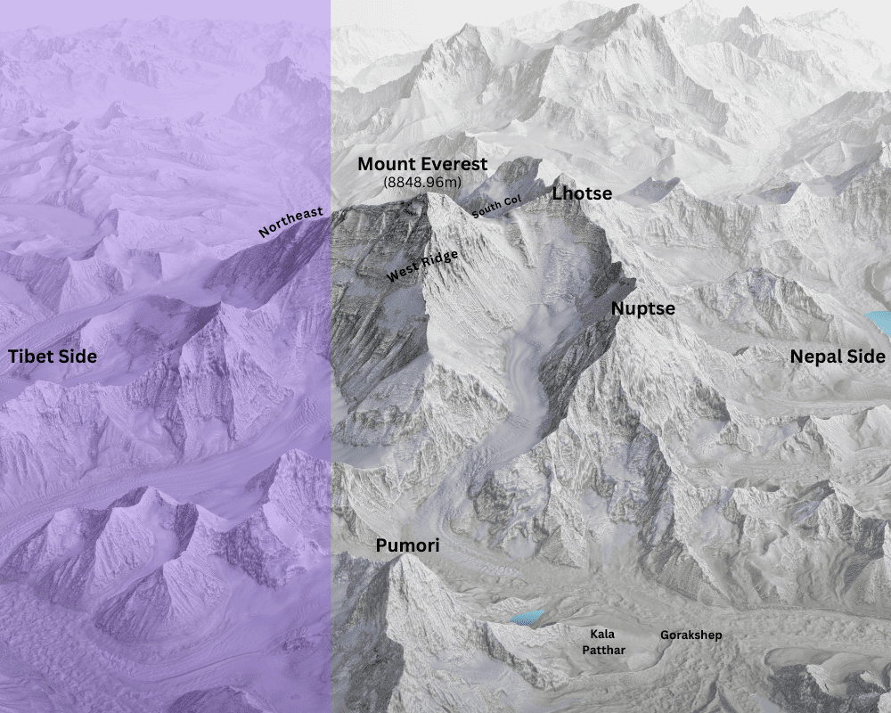
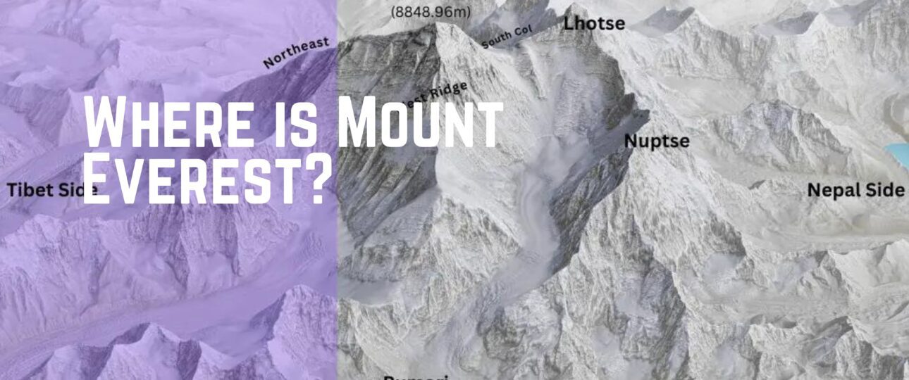
Mount Everest stands tall in the Great Himalayas, a massive mountain range in southern Asia. It’s right on the border between Nepal and Tibet, situated at coordinates 27°59′ North latitude and 86°56′ East longitude, which makes the top peak under the Sagarmatha Zone of Nepal’s Khumbu Region.

The locals have given Mount Everest some beautiful names. In Nepal, it’s called “Sagarmatha,” which means “Forehead of the Sky,” And in Tibet, it’s known as “Chomolungma,” which translates to “Holy Mother.” These names reflect the deep respect and reverence people have for this awe-inspiring mountain.
Geologically speaking, Mount Everest was formed millions of years ago when tectonic plates collided, pushing the Earth’s crust upward to create the Himalayas. It’s a living testament to the incredible forces of nature.
Measuring Everest’s exact height has been a bit of a challenge over the years. But today, we know it stands at a whopping 8,848.96 meters (29,032.021 feet) above sea level. That’s like stacking almost 20 Empire State Buildings on top of each other!
A more detailed blog is written about “How tall is Mount Everest? Understanding the majestic height”.
How to Know Which is Mount Everest
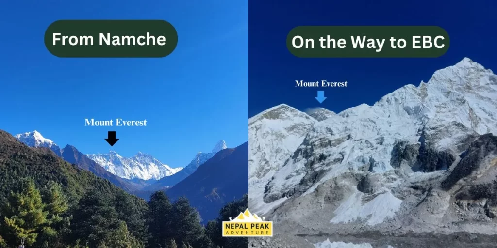
Identifying Mount Everest amidst the Himalayan landscape requires knowledge of its distinct features and surrounding landmarks. The mountain’s towering height, snow-covered peak, and distinctive shape set it apart from other peaks in the region. Look for a towering peak with a distinctive triangular shape, often shrouded in snow and ice. Its prominent height and silhouette set it apart from the surrounding mountains.
Pay attention to features such as the distinctive summit pyramid and the surrounding landscape to confirm that you have indeed captured Mount Everest in all its glory.
When approaching from the Nepal side, the mountain is typically visible from the Everest region, including popular trekking destinations like Namche Bazaar and Everest Base Camp. From Tibet, Everest is visible from viewpoints such as Rongbuk Monastery.

Geology and Surrounding Peaks
Mount Everest, like the other peaks in the Himalayan range, has a fascinating geological history that dates back millions of years. The Himalayas were formed as a result of the collision between the Indian Plate and the Eurasian Plate, a process known as continental drift. Mount Everest is composed of various layers of rock, including metamorphic schists, gneisses, and igneous granites.
Mount Everest is surrounded by some of the world’s most iconic and towering peaks, making the region a breathtaking spectacle. To the immediate south of Everest lies Lhotse, the fourth-highest mountain in the world, standing at 8,516 meters (27,940 feet), and connected to Everest via the South Col.
Close by is Nuptse, with an elevation of 7,861 meters (25,791 feet), forming part of the Everest massif. To the southeast, Makalu, the world’s fifth-highest peak at 8,485 meters (27,838 feet), rises majestically about 19 kilometers from Everest.
Further west, Cho Oyu, the sixth-highest mountain at 8,188 meters (26,864 feet), stands along the Nepal-Tibet border. Adding to the region’s allure is Ama Dablam, known for its stunning beauty and unique shape, towering at 6,812 meters (22,349 feet) to the south of Everest.
Pumori, at 7,161 meters (23,494 feet), lies just 8 kilometers west of Everest, often referred to as the “daughter of Everest” by local Sherpas. Lastly, Gyachung Kang, the fifteenth-highest mountain in the world at 7,952 meters (26,089 feet), is located between Cho Oyu and Everest, on the Nepal-China border.
These peaks together create one of the most awe-inspiring landscapes on Earth, surrounding Everest with a dramatic and majestic skyline.
Glaciers and Glacial Features:
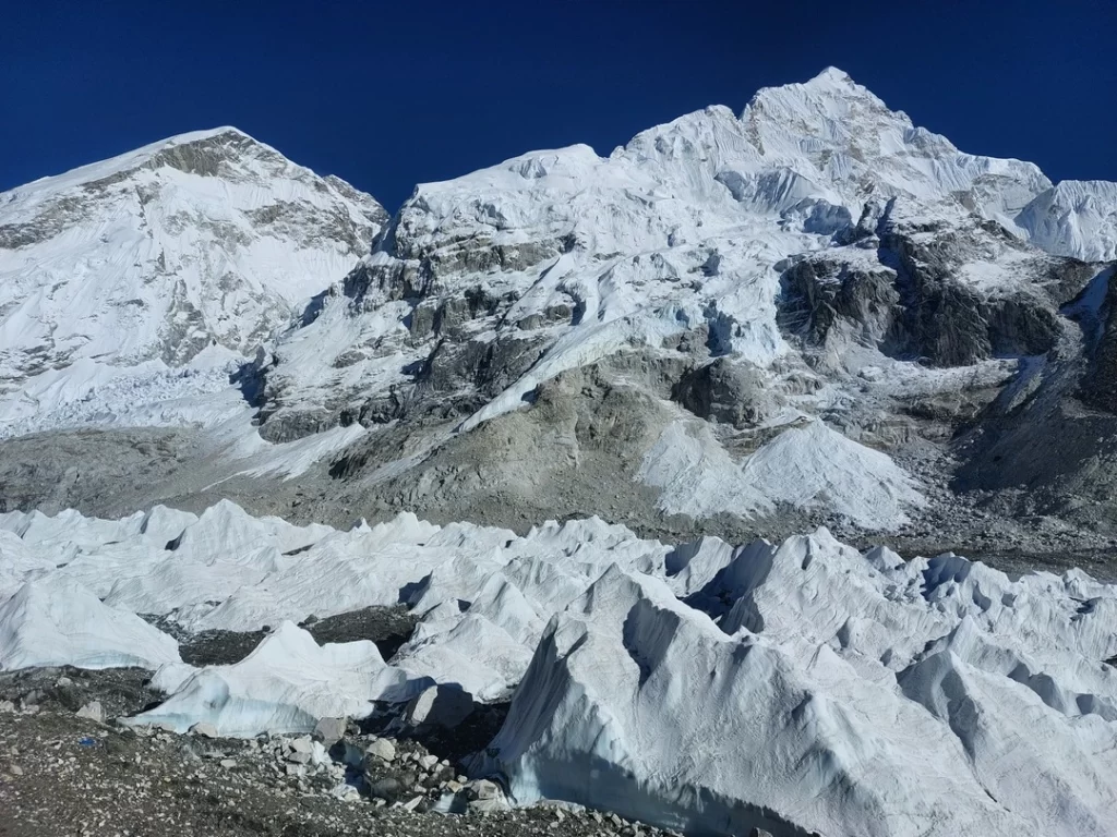
The Himalayas are home to numerous glaciers, including the Khumbu Glacier, which flows from the Western Cwm (cirque) between Everest and Lhotse. Glacial features such as moraines, icefalls, and seracs are common in the Everest region and add to the rugged and dynamic landscape. These glaciers play a crucial role in shaping the surrounding terrain and providing a vital source of water for the region’s rivers and ecosystem.

Where is the best place to view Mount Everest?
One of the most well-known and easily reachable spots to get a close-up look of Mount Everest is Kala Patthar. At 5,643 meters (18,513 feet) above sea level, it provides trekkers with a stunning, all-encompassing vista of Mount Everest and its neighboring peaks, Lhotse and Nuptse.
When the mountains are bathed in golden light at sunrise or sunset, Kala Patthar gives an unmatched perspective, unlike the view from Everest Base Camp, which is near the base of the mountain but has restricted vision of the summit. A common highlight of the Everest Base Camp walk is arriving at Kala Patthar, which offers a sense of wonder and achievement due to its proximity to the highest peak in the world.
Climbing Route to Mount Everest
Climbing Mount Everest, the world’s highest peak, involves two main routes: the Southeast Ridge from Nepal and the Northeast Ridge from Tibet.
The most well-known and frequently traveled route is the Southeast Ridge, which was successfully climbed by Sir Edmund Hillary and Tenzing Norgay in 1953. It begins with a trek through the Khumbu Valley to Everest Base Camp at 5,364 meters (17,598 feet). From there, climbers traverse the dangerous Khumbu Icefall, ascend the Lhotse Face, and traverse the Western Cwm to Camp IV at the South Col.
The final push to the summit involves crossing the dangerous Hillary Step and reaching the peak at 8,848.86 meters (29,031.7 feet).the region.
The Northeast Ridge route from Tibet is less crowded but more challenging due to its harsh weather conditions and longer exposure to high altitudes.
Climbers begin on the Tibetan side, setting up base camp at about 5,150 meters (16,896 feet), moving through intermediate camps, and ending at 6,500 meters (21,325 feet) to reach the Advanced Base Camp. They next climb the North Col to get to the upper camps, where they take on the last few stages, which include the difficult and steep Second Step.
The Northeast Ridge route is known for its strong winds and more technical climbing sections, making it a formidable alternative to the Southeast Ridge.
Know More About Mount Everest


