Everest Base Camp Trek Map
Welcome, fellow adventurers, to a comprehensive exploration of the Everest Base Camp Trek Map. Whether you’re a first-time trekker or a seasoned mountaineer, the allure of Mount Everest and its surrounding peaks beckons with promises of unparalleled beauty and adventure. But before we set foot on this legendary trail, let us first grasp the importance of understanding the terrain, landmarks, and challenges that await us through the lens of a meticulously crafted map.
In this blog series, we will navigate through every aspect of the Everest Base Camp Trek Map, from its geographical features to the invaluable insights it provides for planning and executing a successful trek. So, lace up your boots, pack your gear, and let’s embark on a journey that will not only test our physical endurance but also enrich our souls with the awe-inspiring wonders of the Himalayas.
About the Everest Base Camp Trek
Everest Base Camp is a renowned destination located at the foot of the world’s highest peak, Mount Everest, in the Himalayas of Nepal. Situated at an altitude of approximately 5,364 meters (17,598 feet), it serves as the starting point for climbers attempting to summit Everest via the South Col route.
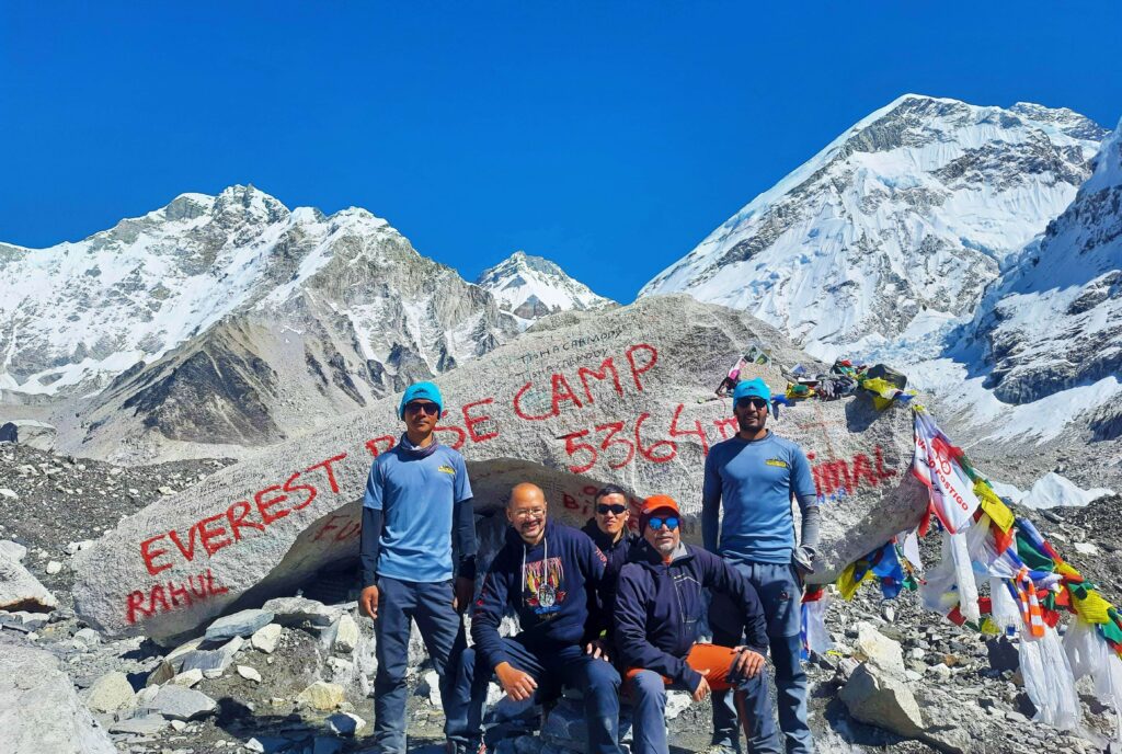
The journey to Everest Base Camp is an iconic trekking experience that attracts adventurers from around the globe. Trekkers traverse through picturesque landscapes, including lush forests, rugged terrain, and high-altitude alpine regions, while immersing themselves in the rich culture and traditions of the Sherpa people who inhabit the region.
Reaching Everest Base Camp offers trekkers awe-inspiring views of the surrounding peaks, including Everest itself, as well as opportunities to interact with fellow adventurers and experienced mountaineers. It’s a challenging yet rewarding adventure that provides a profound sense of accomplishment and a deep connection to the natural wonders of the Himalayas.
Everest Base Camp Trekking Route
The Everest Base Camp trekking route is a legendary trail that winds its way through the stunning landscapes of the Khumbu region in Nepal. Beginning in the bustling town of Lukla, trekkers embark on a journey that takes them through verdant forests, picturesque Sherpa villages, and rugged mountain terrain.
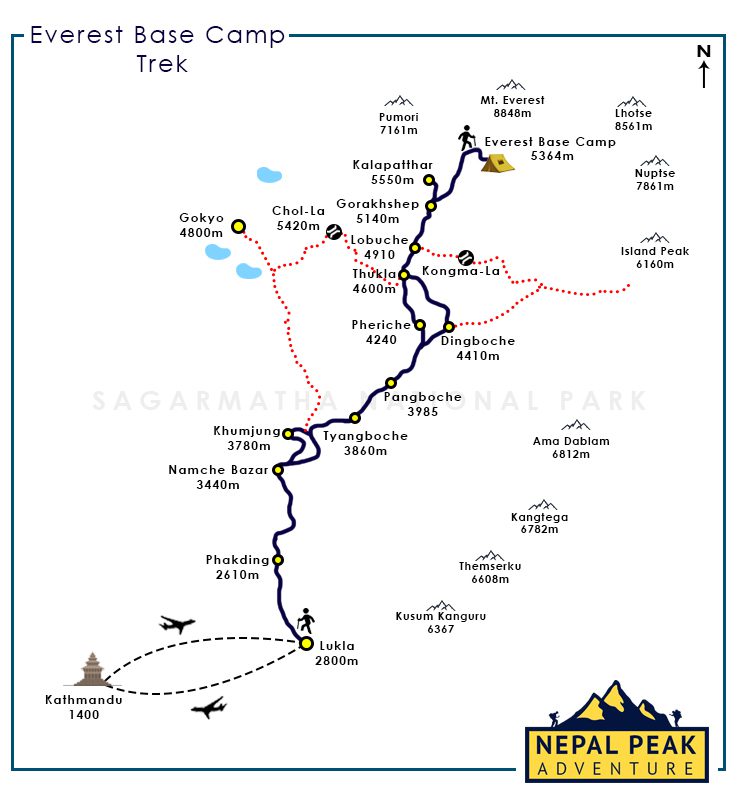
The route follows the footsteps of legendary mountaineers and adventurers, passing through iconic landmarks such as Namche Bazaar, the bustling hub of the Khumbu region, and Tengboche Monastery, a spiritual oasis amidst the towering peaks. Along the way, trekkers are treated to breathtaking views of some of the world’s highest mountains, including Everest, Lhotse, and Ama Dablam.
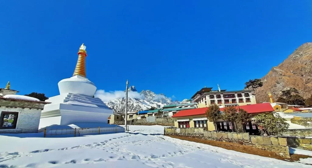
As the trail ascends into the alpine zone from Pangboche and above (Dingboche, Lobuche and Gorakshep), trekkers must navigate challenging terrain and high-altitude conditions, including steep ascents and rocky paths. Yet, the rewards are plentiful, with each step bringing trekkers closer to the ultimate destination: Everest Base Camp.
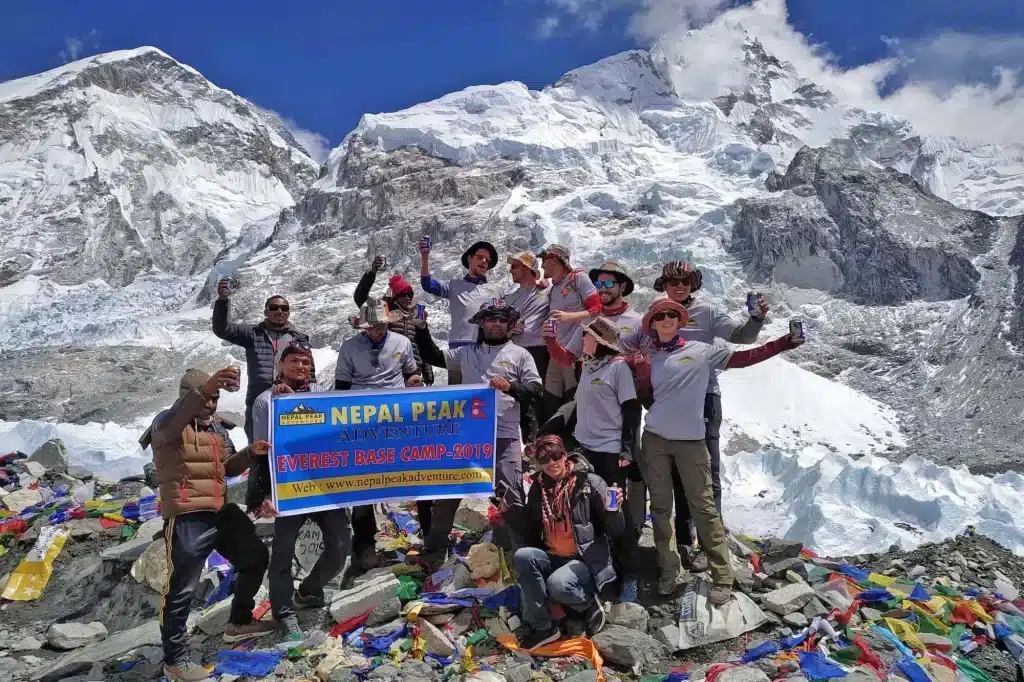
At an altitude of over 5,364 meters (17,598 feet), Everest Base Camp sits in the shadow of the towering Everest, offering trekkers a once-in-a-lifetime opportunity to stand in awe of the world’s highest peak. Surrounded by towering glaciers and majestic peaks, the base camp serves as a testament to human perseverance and the indomitable spirit of adventure.
Major Stops on the Everest Base Camp Trek
The Everest Base Camp trek encompasses several major stops that are integral to the journey’s experience and success.
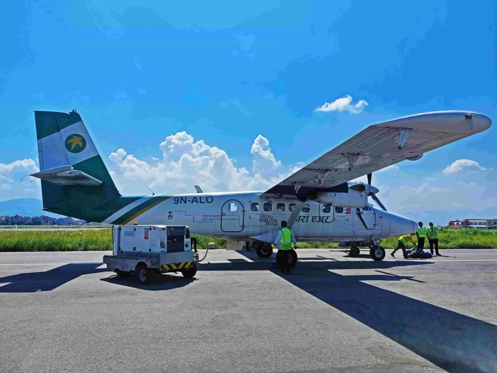
Beginning with Phakding, situated at an elevation of around 2,610 meters (8,563 feet), trekkers kick start their adventure after flying into Lukla and embarking from there.
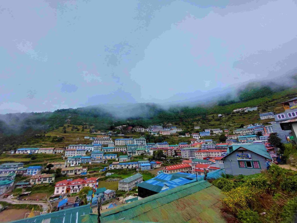
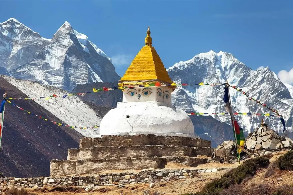
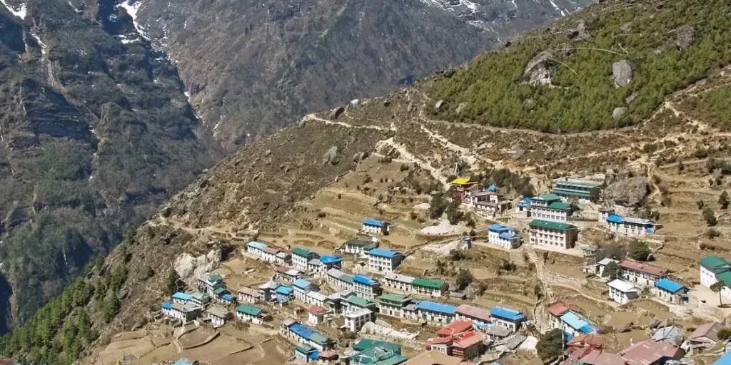
Namche Bazaar, the largest settlement in the Khumbu region at approximately 3,440 meters (11,286 feet) above sea level, offers a bustling Sherpa town experience and serves as a crucial acclimatization point. Here, trekkers explore local markets, museums, and monasteries before continuing onward.
Tengboche, alternatively known as Tyanboche, stands out for its iconic monastery, Tengboche Monastery, positioned at approximately 3,870 meters (12,696 feet). It’s a revered stop where trekkers engage in its daily rituals and relish panoramic views of Everest and neighboring peaks.
Dingboche, nestled in the Imja Valley at around 4,410 meters (14,468 feet), provides trekkers with an idyllic acclimatization spot and awe-inspiring vistas of Island Peak and Lhotse.
Lobuche, a modest settlement situated at about 4,910 meters (16,109 feet), serves as a final resting place before the push to Everest Base Camp, offering essential amenities and a base for exploring nearby attractions like the climber memorial.
Finally, Gorak Shep, located at approximately 5,164 meters (16,942 feet), marks the last stop before reaching Everest Base Camp. Here, trekkers gather their strength for the final leg of the journey, whether it’s tackling the hike to Base Camp itself or ascending Kala Patthar for unparalleled views of Everest and its surroundings.
Pheriche on the other hand is the stop where you will stop while descending back down after successfully reaching the Everest Base Camp.
These major stops not only provide essential rest and acclimatization opportunities but also offer trekkers unforgettable experiences and breathtaking vistas of the Himalayan landscape.
Importance of having the Everest Base Camp Trek Map
Understanding the Terrain:
The Everest Base Camp Trek Map serves as a visual representation of the terrain that trekkers will encounter along the trail.
From lush valleys to towering peaks, each contour line and elevation point offers valuable information about the topography of the region.
By studying the map, trekkers can anticipate changes in elevation, identify potential challenges, and plan their route accordingly to ensure a safe and fulfilling journey.
Navigating Landmarks and Points of Interest:
Beyond its practical utility, the Everest Base Camp Trek Map is a treasure trove of cultural and natural landmarks waiting to be discovered.
From ancient monasteries to breathtaking viewpoints, the map highlights key points of interest that enrich the trekking experience and offer insights into the region’s rich history and culture.
By referencing these landmarks, trekkers can immerse themselves in the unique charm of the Khumbu Valley and forge a deeper connection with the land and its people.
Planning and Preparation:
A successful trek to Everest Base Camp begins long before setting foot on the trail, and the Everest Base Camp Trek Map plays a crucial role in the planning and preparation process.
Trekkers can use the map to chart their course, estimate travel times between checkpoints, and identify potential rest stops and accommodation options along the way.
Additionally, the map serves as a vital safety tool, allowing trekkers to communicate their intended route with guides and fellow hikers and mitigate the risks associated with high-altitude trekking.
By delving into these aspects of the Everest Base Camp Trek Map, trekkers can gain a comprehensive understanding of the trail and maximize their chances of success and enjoyment. Whether embarking on their first trek or seeking to conquer new heights, the map serves as a trusted companion, guiding them every step of the way through the breathtaking landscapes of the Himalayas.
Different Formats of the Everest Base Camp Trek Map
The Everest Base Camp Trek Map is available in a variety of formats to cater to the diverse needs of trekkers embarking on this legendary journey.
Printed topographic maps offer detailed information about the terrain, elevation, and landmarks along the trekking route, providing trekkers with essential guidance during their adventure.
Digital maps, accessible through smartphones, tablets, or GPS devices, offer real-time navigation and the convenience of updates, ensuring trekkers have the latest trail information at their fingertips.
Interactive online maps provide a virtual exploration of the trekking route, with features such as satellite imagery and user-generated content enhancing the planning process.
Guidebooks and trail maps combine detailed maps with practical information and trekking tips, offering comprehensive resources for trekkers seeking in-depth insights into the region.
Additionally, customized maps provided by trekking agencies offer personalized route recommendations and support, ensuring trekkers have a tailored experience suited to their preferences.
Whether in print or digital form, the Everest Base Camp Trek Map serves as an indispensable tool for trekkers, guiding them through the breathtaking landscapes of the Himalayas with confidence and ease.
