Where is Mount Manaslu located?
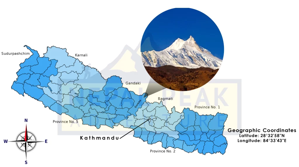
Mount Manaslu, also known as Kutang, is the eighth-highest mountain in the world, with an elevation of 8,163 meters (26,781 feet). So, where is Mount Manaslu located exactly? It is located in the Mansiri Himal range, part of the larger Nepalese Himalayas, in the west-central region of Nepal. The mountain lies approximately 64 kilometers (40 miles) east of Annapurna, another prominent peak in the Himalayas.
Geographic Location of Mount Manaslu
Mount Manaslu is situated in the Gorkha District of Nepal. The geographical coordinates of Manaslu are approximately 28°32′58″N latitude and 84°33′43″E longitude. The mountain is part of the Mansiri Himal, a subrange of the Nepalese Himalayas. The region around Manaslu, known as the Manaslu Conservation Area, encompasses a diverse range of ecosystems, ranging from subtropical forests to alpine zones.
Geographic Coordinates
Latitude: 28°32′58″N
Longitude: 84°33′43″E

Neighboring Peaks
Manaslu is surrounded by several notable peaks within the Mansiri Himal range. These include:
Himalchuli: 7,893 meters (25,896 feet)
Ngadi Chuli (Peak 29): 7,871 meters (25,823 feet)
Shringi Himal: 7,187 meters (23,579 feet)
Ganesh Himal: To the east, with peaks reaching up to 7,422 meters (24,350 feet)
Nearby Valleys and Rivers
Budhi Gandaki River: This river flows from the Manaslu Glacier and carves through the deep gorges of the region, eventually joining the Trishuli River.
Marsyangdi River: Located to the west of Manaslu, this river runs parallel to the Annapurna Circuit.
Starting Points for Treks
Arughat: A popular starting point for the Manaslu Circuit Trek, accessible by road from Kathmandu.
Soti Khola: Another common starting point for trekkers, located a bit further along the route from Arughat.
Trekking Routes
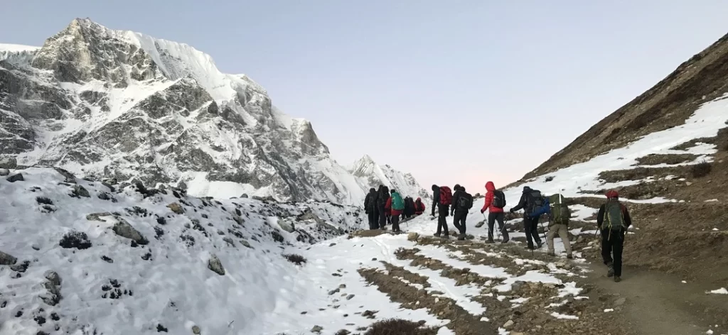
The Manaslu Circuit Trek is one of the key trekking routes in the region, offering a loop around the mountain. Key locations along this trek include:
Jagat: A village at 1,340 meters (4,396 feet), known for its checkpoint and entry into the Manaslu Conservation Area.
Deng: A settlement at 1,860 meters (6,102 feet), marking the beginning of Tibetan-influenced culture.
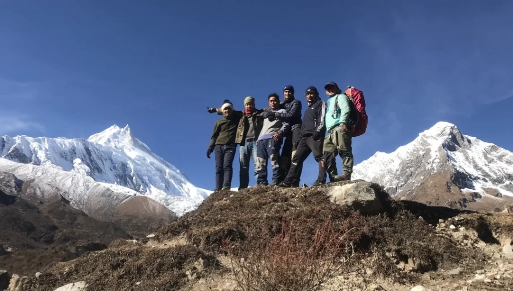
Namrung: A village at 2,660 meters (8,727 feet) offering views of Manaslu.
Samagaon: A prominent village at 3,530 meters (11,581 feet), near the base camp of Manaslu and home to ancient monasteries.
Samdo: Located at 3,875 meters (12,713 feet), it is one of the highest villages in the region, close to the Tibetan border.
Larkya La Pass: The highest point of the trek at 5,160 meters (16,930 feet), offering panoramic views of the surrounding peaks.

Name and Significance of Mount Manaslu
The name “Manaslu” is derived from the Sanskrit word “Manasa,” which means “intellect” or “soul.” Locally, it is also known as “Kutang.” The mountain is revered in the local Tibetan culture, and the name reflects the spiritual significance attributed to it.
Climbing History
Climbing Mount Manaslu is a formidable challenge due to its technical difficulty and the risks associated with avalanches and crevasses. However, it has become increasingly popular among climbers seeking to test their skills on an 8,000-meter peak. Its allure lies not only in its physical demands but also in the stunning and relatively untouched landscapes that surround it.
Whether you are an avid mountaineer, a passionate trekker, or someone intrigued by the natural and cultural wonders of the Himalayas, Mount Manaslu offers a unique and enriching experience. This iconic peak stands as a testament to the beauty and challenge of high-altitude exploration, inviting adventurers from around the world to discover its secrets.
The first successful ascent of Mount Manaslu was made on May 9, 1956, by a Japanese expedition led by Toshio Imanishi and Gyalzen Norbu, a Sherpa climber. This marked Japan’s significant entry into the arena of Himalayan climbing. Since then, Manaslu has been a popular destination for mountaineers, although it is considered a technically demanding climb due to its challenging terrain and the risks associated with avalanches and crevasses.
In recent years, Mount Manaslu has gained popularity among climbers as a preparatory peak for those aiming for Mount Everest expeditions and other 8,000-meter mountains. Its challenging terrain, high altitude, and relatively lower cost compared to Mount Everest make it an attractive option.
The number of expeditions to Manaslu has increased significantly, with many commercial expeditions offering guided climbs. This has led to concerns about overcrowding and environmental impact, similar to those faced on other popular Himalayan peaks.
What is the distance of Mount Manaslu from Kathmandu?
Mount Manaslu is approximately 100 kilometers (62 miles) northwest of Kathmandu, the capital city of Nepal. This distance is often measured in a straight line or “as the crow flies”, but the actual travel distance varies depending on the chosen route and mode of transportation, given the mountainous terrain.
Typically, travelers start from Kathmandu and drive to Arughat or Soti Khola, the main gateways for the Manaslu Circuit Trek. The road journey to Arughat takes about 6-8 hours and covers approximately 126 kilometers (78 miles) via the Prithvi Highway and secondary roads. From Arughat or Soti Khola, trekkers proceed on foot towards Mount Manaslu, with the trek to the base camp taking around 7-10 days, depending on the itinerary and acclimatization needs.
Key stops on this route include villages such as Machha Khola, Jagat, Deng, Namrung, Samagaon, and Samdo.
For a quicker but more expensive option, helicopters can be chartered from Kathmandu to locations closer to the base camp, significantly reducing travel time but bypassing the trekking experience.
Thus, while the straight-line distance is about 100 kilometers, the actual travel involves a combination of driving and trekking, covering a greater distance and offering an immersive experience of Nepal’s diverse landscapes and cultures.
Manaslu Routes and Trekking
The most common route to the summit is via the northeast face. The climb typically involves establishing several high camps above the base camp, which is situated at around 4,800 meters (15,750 feet). The ascent is known for its steep ice and snow slopes, as well as the crevasse-ridden Manaslu Glacier.
Apart from climbing, the region around Mount Manaslu is also famous for the Manaslu Circuit Trek, a trek that encircles the mountain. This trek offers breathtaking views of Manaslu and the surrounding peaks, and it passes through diverse cultural and ecological zones. The trek typically starts in the town of Arughat or Soti Khola and traverses through various villages, culminating in crossing the Larkya La pass at an altitude of 5,160 meters (16,930 feet).

Manaslu Conservation Area
The Manaslu region was declared a conservation area in 1998. The Manaslu Conservation Area covers 1,663 square kilometers (642 square miles) and is managed by the National Trust for Nature Conservation (NTNC). The area is home to a rich variety of flora and fauna, including endangered species such as the snow leopard and the Himalayan musk deer. The conservation area also focuses on preserving the cultural heritage of the local communities, which include the Gurung and Tibetan ethnic groups.
Environmental and Cultural Impact
Mount Manaslu and its surrounding regions are of great environmental and cultural importance. The mountain’s diverse ecosystems support a variety of wildlife, and the area is a critical zone for biodiversity conservation. Culturally, the region is rich with Tibetan Buddhist heritage, and several monasteries and religious sites are located along the trekking routes.
In summary, Mount Manaslu is a prominent peak in the Himalayas, renowned for its challenging climbs and stunning natural beauty. Its significance extends beyond mountaineering, encompassing important cultural and ecological values that contribute to its unique status in the region.


