Island Peak Climbing Map
The Island Peak Climbing Map is a comprehensive and reliable guide that provides detailed information for climbers embarking on the Island Peak expedition. This high-quality digital map showcases various aspects of the trek, including resting grounds, peaks, primary and secondary trails, and significant landmarks.
With up-to-date updates and accurate portrayals, the map offers valuable insights into the trekking routes, climbing paths, and geographical features such as glaciers, lakes, rivers, and campsites.

Importance of an Island Peak Climbing Map:
A climbing map plays a pivotal role in ensuring a safe and successful ascent of Island Peak. With its rugged terrain, unpredictable weather, and complex network of trails, having a reliable and accurate climbing map is of utmost importance. Let’s explore the significance of a climbing map for Island Peak and how it aids climbers in their journey.
First and foremost, a climbing map enhances safety and navigation. It provides climbers with vital information about the routes, including key landmarks, rest points, and potential hazards.
Detailed information about the map’s content and quality
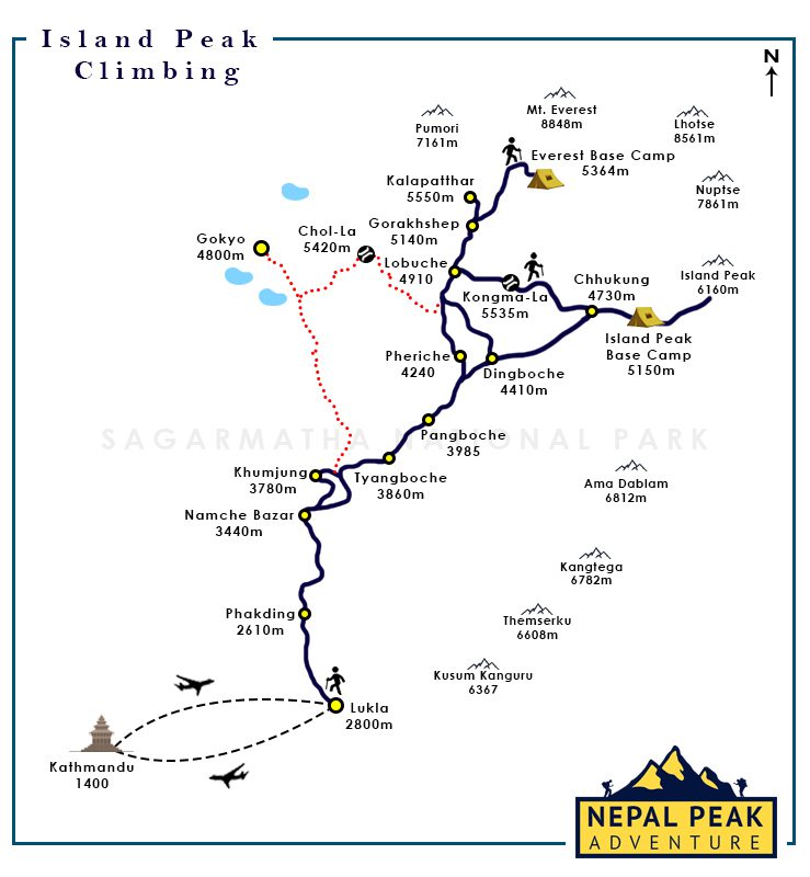
The journey to Island Peak typically spans around two weeks, although variations in routes can extend the duration. The trek commences from Lukla, the gateway to Island Peak, where a scenic flight transports climbers to this starting point.
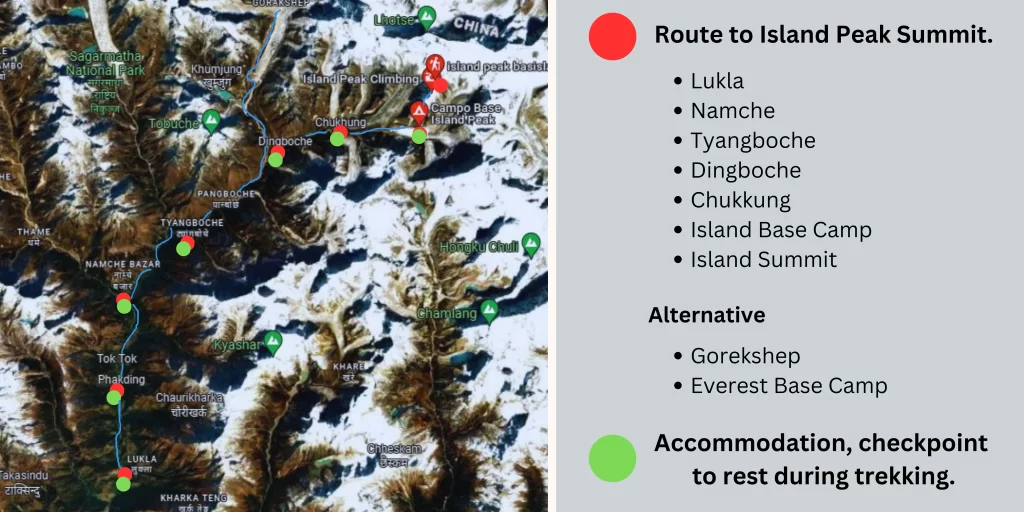
Following the well-established trail of the Everest Base Camp, the journey leads through picturesque locations like Namche, Phakding, Tengboche, and Dingboche. From Dingboche, the trail diverges towards Chukkung and Chukkung Ri instead of continuing to Lobuche. The subsequent day brings climbers to the Island Peak base camp, where a day is devoted to acclimatization and pre-climbing training to prepare for the final ascent.
The climbing route to the summit of Island Peak aligns with the classic trail of Everest Base Camp. Notable stops along the way include Lukla, Namche, Phakding, Tengboche, Dingboche, Chhukung, Chhukung Ri, and Island Peak Base Camp. At the base camp, climbers undergo essential training and preparation for the ultimate climb to the peak. Skilled climbing leaders demonstrate the necessary techniques and familiarize climbers with the required gear and equipment to overcome the challenges ahead.

Acclimatization opportunities according to Island Peak Map:
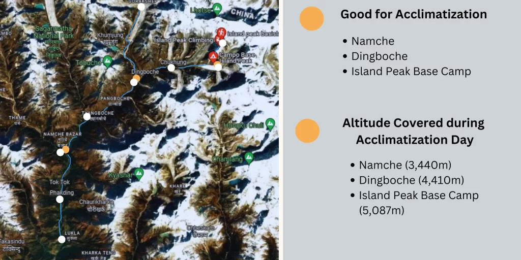
During your Island Peak climbing expedition, acclimatization and training play vital roles in ensuring a safe and successful ascent. The Island Peak Climbing Map provides valuable information about acclimatization points and training opportunities along the route, allowing you to prepare adequately for the challenges ahead.
Acclimatization: As you gain altitude, acclimatization becomes essential to adapt your body to the changing environment and reduce the risk of altitude-related illnesses. The map identifies specific locations where acclimatization days are recommended, such as Namche Bazaar and Dingboche.
These rest days provide an opportunity for your body to adjust to the altitude and increase your chances of a successful climb. By following the suggested acclimatization points on the map, you can optimize your itinerary and prioritize your well-being.

Encouragement to use the map for a successful climbing expedition:
As you embark on your Island Peak climbing adventure, I strongly encourage you to carry the Island Peak Climbing Map along with a compass. These essential tools will serve as your navigational companions, helping you stay on the designated route, identify crucial landmarks, and make informed decisions throughout the journey. By utilizing the map’s detailed information and features, you can confidently navigate the terrain, anticipate challenges, and optimize your itinerary for a successful ascent.
The cost of one Island Peak Climbing Map can range from NRS 300 to NRS 1000 depending upon the map details and quality.
Conclusion:
In conclusion, by utilizing the Island Peak Climbing Map and understanding its features, you equip yourself with a powerful tool that enhances your climbing experience. It empowers you to navigate with precision, make informed decisions, and ultimately, achieve your goal of reaching the summit of Island Peak.
If you are more interested in Island Peak Climbing then here are some useful links to follow:


